
- Robotics - Automation - Industrial IT
- Industrial Software
- Management software
- ARC Informatique
地理数据管理软ware
cartography
mapping

添加到收藏夹”
Compare this product
Characteristics
- Function
- geographical data management, cartography, mapping
Description
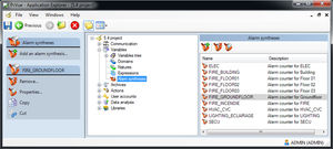
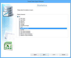
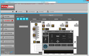
A geographic information system (GIS) is a computer system designed to manipulate, and represent all types of geographical data. GIS is a relatively broad term that can refer to a number of different technologies and operations also called services such as: Cartography: the design and production of maps Mapping: the process of using maps delivered by geographical information systems (GIS) to display map and overlay with customized markers Geoprocessing: to manipulate spatial data ie : find the shortest route on street network PcVue GEO Map Control The PcVue GEO Map Control is a built-in PcVue component client for a GIS mapping service which : Displays an interactive map provided by map providers Online & Offline both supported Allows an easy map manipulation with integrated functions such as panning and zooming Displays overlays with custom dynamic objects (Markers) including PcVue animated symbols
Catalogs
No catalogs are available for this product.
See all of ARC Informatique‘s catalogs


Related Searches
- Analysis software
- Management software
- Automation software
- CAD software
- Process software
- Windows software
- Design software
- Measurement software
- Real-time software
- Monitoring software
- Visualization software
- Industrial software
- Interface software
- Network software
- EDM software
- Reporting software
- Creation software
- Mobile GIS data collection software
- Data management software
- PLC software
*Prices are pre-tax. They exclude delivery charges and customs duties and do not include additional charges for installation or activation options. Prices are indicative only and may vary by country, with changes to the cost of raw materials and exchange rates.
0/10 products to compare